Cartographic Services:
• Historic and Military Mapping
The Silk Routes across Asia, Hannibal’s Campaigns, the Mongol empires, El Alamein, and the Inca civilisation, are just a few examples where relief has had a major influence on world history.
Using the latest digital techniques Geo-innovations has uniquely developed clear and accurate representations of the Earth’s terrain, designed specifically for military and historical mapping. All you have to do is give us a sketch of the area you wish to cover and Geo-Innovations will respond immediately with jpeg roughs for you to consider, without obligation. Images can be re-projected and coloured to fit any existing work or conversely we would be happy to prepare the whole map series to your specification. Sometimes a panoramic image would better show the events you wish to describe. We can do that too, any angle, any scale.
 • General Book Publishing & Packaging • General Book Publishing & Packaging
If the publishers nightmare is having to constantly dream up something different for each new edition or product, then terrain visualisation must be a publishers dream. Each image produced is to the clients specification and has never been seen before. A unique product every day, no two images are ever the same.
Our experienced cartographers and animators are happy to work with authors directly or with designers in packaging companies, to produce the very best in mapping for the publishing industry. Perhaps you have a project just waiting for the right techniques to come along or even, having seen our work on these pages, a new idea might spring to mind. Please get in touch and have a chat, we would be delighted to talk with you.
 • Children's Books • Children's Books
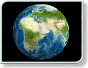
To look at the world through the eyes of an Eskimo, a Laplander, an Aborigine, or a Mongolian is to see with other eyes, which gives children a new and liberating perspective on the world.
The distorted perceptions of the world generated by the universal use of Mercators Projection in many western school wall-maps, has come to haunt many of us from older generations. We were led to believe that this was what the world was actually like, and it crippled our thinking for decades afterwards. What better place to start then, than with the education of future generations, if we show them the world as it really is rather than as our mentors would have us believe it to be. To show children a true image of the world before that image can become distorted by vested interests is a worthy aim. Why should north always be at the top when the subject matter would be better served by looking south or looking east? Geo-Innovations panoramic and traditional maps are specially designed using the latest child centred research to produce clear illustrative views of the world as it really is.
• School Text Books
We have extensive experience in producing artwork for examination papers and school textbooks. With terrain visualisation we may for the first time understand the role that relief has had on economic geography and world history.
 • Airline Route Maps • Airline Route Maps
We believe that you cannot treat an airline map in the same way as you would treat any other atlas map. The art in creating airline maps is to reflect the passengers psychological experience of being in the world but not of it, being part of the world but somehow separated from it. Flying above the earth is a unique sensation and maps should enhance that experience. Geo-Innovations terrain visualisations, with clouds if required, give a whole new perspective to in flight magazines. Additionally our map graphics have an instant popular appeal and may become a key marketing tool in this very competitive industry.
 • Tourism and Travel • Tourism and Travel
The potential for these products for encouraging tourists to an area has not yet been fully realised. However it is proven that these images elicit a desire in the reader to go to the place illustrated, especially if atmospheric effects have been generated. Our experience in dealing with national and regional tourist boards shows that realistic yet intensely graphic images of regions and countries has a positive effect on potential travellers.
• Holiday Brochures
Everybody wants to see some ‘eye candy’ of their prospective resorts. Our product gives a sense of realism never before achieved in any holiday brochure.
• Advertising, Promotion and Sales
The promotional power of our images of the earth is impressive. Eye-catching terrain visualisations, capture the imagination and enhance the promotional value of any marketing or advertising campaign. Additionally, for deep routed psychological reasons, people keep maps and remember map related products long after other advertising media has been consigned to the bin.
• Atlas Publishing
It goes without saying that one of the main beneficiaries of these new developments in relief representation has been the atlas publishing industry. Working closely with a customers own design and editorial staff, Geo-Innovations has created the ability to see the world from a different point of view, to show the earths surface and its structural features in ways that conventional techniques  cannot. At last we can supersede vague contouring and the vagaries of artistic hill shading, with real geo-referenced relief data re-projected to match existing coastlines and communications. This adds a whole new dimension to conventional atlases, and with scale capabilities of up to 1:250.000 even road atlases can now be benefit from terrain visualisation. cannot. At last we can supersede vague contouring and the vagaries of artistic hill shading, with real geo-referenced relief data re-projected to match existing coastlines and communications. This adds a whole new dimension to conventional atlases, and with scale capabilities of up to 1:250.000 even road atlases can now be benefit from terrain visualisation.
Vertical exaggeration can also be adjusted infinitely, to the clients specification, and the relief coloured to complement the house style,
However; that is only half of the story, Geo-Innovations opens up a new horizon by showing the earths physical features in 3D with stunning panoramic images. Why can’t a map have sky? Why can’t you look up at mountains for a change instead of always looking down on them?. Many of the worlds leading atlas publishers have already realised the dramatic way in which these images are ushering in a new era in atlas mapping, whilst also benefiting from the instant sales and marketing appeal of terrain visualisation.
• Cartographic Animation
 Already, Geo-Innovations is gearing up for the next big development in atlas and media publishing; animation. The printed page is an indispensable format for communicating geographical information, but the digital world offers many new opportunities, maps that move, maps with sound and maps that interact with the user. CD / DVD and internet delivery of maps opens up a new wave of media presentation capabilities. Because most of the staff at Geo-Innovations were animators before they were cartographers, they understand this media perfectly. Fly throughs, 360° spin arounds, and sub sea explorations are just a few of the new opportunities presenting themselves to the publishing world as additional promotional features in books and atlases. Already, Geo-Innovations is gearing up for the next big development in atlas and media publishing; animation. The printed page is an indispensable format for communicating geographical information, but the digital world offers many new opportunities, maps that move, maps with sound and maps that interact with the user. CD / DVD and internet delivery of maps opens up a new wave of media presentation capabilities. Because most of the staff at Geo-Innovations were animators before they were cartographers, they understand this media perfectly. Fly throughs, 360° spin arounds, and sub sea explorations are just a few of the new opportunities presenting themselves to the publishing world as additional promotional features in books and atlases.

TV and MEDIA Presentations
Cartographic animation and terrain visualisations come into their own most fully in the TV and media environments. Geo-Innovations provides a truly digital product for the film and media settings far out-stipping anything currently on the market. Ideal for news, documentaries, films, promotional videos and DVD’s.
|
|