|
|
|
|
|
|
|
|
• TERRAIN VISUALISATION. A fresh look at representing relief.
|
|
 |
|
 CHANGING THE WAY WE LOOK AT THINGS. CHANGING THE WAY WE LOOK AT THINGS.
From the most accurate global relief data available, our professional teams of cartographers and animators at Geo-Innovations are creating physical and panoramic maps of incredible accuracy and detail, for many of the worlds major publishers.
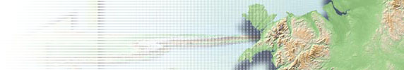
In the past, the production of maps has been constrained by centuries old concepts and restrictions, none more so than with attempts to show relief. Hachuring, contouring, hill-shading and layer tinting are just some of the cartographic fictions employed in the past to describe our landscapes. But now, Geo-Innovations, Britain’s leading exponent of world terrain visualisation and 3D mapping, has replaced fiction with fact, and introduced a new era in relief mapping, truly cartographic, geo-referenced constructs which may be interrogated and manipulated at will. |
|
|
|
|
We therefore invite you to take a fresh look at the landscape through the eyes of Geo-Innovations. |
|
|
 |
|
|
 • Vertical Exaggeration • Vertical Exaggeration
The ability to manipulate height enhancement is a unique feature of terrain visualisation techniques. Unlike other products on the market, many of which are constructed from hand made models,  Geo-Innovations, uses data from a variety of accurate digital elevation and contour sources. This enables us to utilise digital enhancements, tailor made to give you a choice of how much you want the relief to dominate. This technique has never been made available to the commercial world before, as a standard product. Geo-Innovations, uses data from a variety of accurate digital elevation and contour sources. This enables us to utilise digital enhancements, tailor made to give you a choice of how much you want the relief to dominate. This technique has never been made available to the commercial world before, as a standard product.
Because the terrain visualisations are created using pseudo light sources, any increase or decrease in vertical exaggeration has dramatic effects on the visual enhancements achieved. A standard value for vertical exaggeration gives a good all round relief effect and can be used in many general purpose and thematic operations. A low value for height enhancement  would allow you to superimpose a great deal of custom data over the relief background. This is ideal for detailed atlas pages and road maps. would allow you to superimpose a great deal of custom data over the relief background. This is ideal for detailed atlas pages and road maps.
Fuller height enhancements are when the relief data really comes into its own, and these would be used when the relief is almost a stand alone product with little further information added.
 • Hypsometric Colouring • Hypsometric Colouring
The colouring of the various height values (hypsometric tinting) is entirely at your discretion and would be matched to any specification, including any existing work you may want to complement. (Colouring may also be by vegetation type if preferred, or from a selection of standard ranges).
 • The number of colour shades possible is impressive, with a theoretical limit of 64.000. • The number of colour shades possible is impressive, with a theoretical limit of 64.000.
Two varieties of shading are available. A. the cartographic contour method where each height colour changes to the next at a pre-selected level, e.g. 200 metres, 500 metres 1000 metres etc. Or, B. the vignette method in which each colour shades gently into the next.
Because the landscape generation is a product of the ambient surroundings, colours can be muted, pastel or dramatic as required. |
|
• Hill Shading
 Hill shading is an old craft technique where artists simulated the earths relief using soft pencils , crayons or airbrushes. The technique, whilst merely an artists impression, was often very effective and may be found in many older atlases from the 60’s to the 90’s. The passing of these skills has left a gap in cartographic procedures which the digital world has yet to fulfil adequately. Utilising our skills of 30 years of traditional hill shading, we are therefore proud to announce that, by integrating the traditional and the digital, we have created a series of beautiful hill shade techniques perfectly suited to atlas and map backgrounds. Being a digital product, our hill shades have the additional advantage over the traditional artwork techniques in that endless variations can be produced from the same dataset. Again, projection and colour are infinitely variable. Hill shading is an old craft technique where artists simulated the earths relief using soft pencils , crayons or airbrushes. The technique, whilst merely an artists impression, was often very effective and may be found in many older atlases from the 60’s to the 90’s. The passing of these skills has left a gap in cartographic procedures which the digital world has yet to fulfil adequately. Utilising our skills of 30 years of traditional hill shading, we are therefore proud to announce that, by integrating the traditional and the digital, we have created a series of beautiful hill shade techniques perfectly suited to atlas and map backgrounds. Being a digital product, our hill shades have the additional advantage over the traditional artwork techniques in that endless variations can be produced from the same dataset. Again, projection and colour are infinitely variable. |
|
• Bathymetric data
Data is also held for the sub sea elevations and this can be fully incorporated into any terrain visualisation, or may be used as a stand alone product if required.
|
|
|

• Scales
• Seamless world data at 5km resolution suitable for scales of up to 1:10 million
• Seamless world data at 1km resolution suitable for scales from 1:10 million to 1:2 million
• Seamless world data at 90 metre resolution suitable for scales from 1:2million to 1:250.000
• Local data where available with a 10 metre resolution and suitable for scales up to 1:25.000
|
|
|
|
|
") • Geo-referencing, Re-Projection and GIS • Geo-referencing, Re-Projection and GIS
All Geo-Innovations atlas products are geo-referenced. This allows relief images to be re-projected and customised to fit any existing maps or atlases, or alternatively incorporated directly into your GIS systems. The possible applications in the Geomantics fields are therefore almost unlimited, allowing geo-referenced photographic, topographic or custom data to be draped over the relief images.
• File formats
Files may be transmitted or received in any number of formats depending on your requirements. Geo-referenced tif, Adobe Illustrator and Photoshop (300dpi print resolution up to A1), as well as a full range of Autocad and GIS formats, such as Arc-Info, Arc-View, Map Publisher etc.
• Atlas Maps and Wall maps

As well as worldwide relief coverage, in any colour and height enhancement we also offer re-projected and geo-referenced rivers, lakes, political boundaries and major centres of population to match. These make ideal wall maps.
 • Accuracy • Accuracy
Because of the unique systems of landscape generation used by Geo-Innovations, the final images are the clearest and most accurate that could be achieved at the chosen scale. Unlike photographic enlargements and reduction which merely alter the size of the relevant information points, the technique we employ involves redundancy and acquisition of data as the scales vary. As a scale gets smaller, pixels of information are removed or amalgamated as required so that the final image does not appear too cluttered. As scales increase, data is acquired from the database (up to the maximum scale for the data), and added as necessary, thereby ensuring that the images are not too generalised.
The unique feature of these new digital relief maps is that, images produced will remain unchallenged for the next 50 years! Due to the quantity and quality of the data being used, it will not be possible to get any greater degree of accuracy at the chosen scale than currently provided. |
|
|
 • The Planets • The Planets
We currently hold terrain data for the whole of Mars, and will complete our acquisition of other planets in the solar system as they become available.
• Data Sources
Geo-Innovations uses the most comprehensive data sources available. These include, GTOPO5 and GTOPO30 from the United States Geological Survey.....
• Copyright Free
All the world data held by Geo-Innovations comes from copyright free sources.
|
|
|
|
|
|
|
|
Please use these pages not only as a reference for what we have done in the past, but also as starting point for your own ideas for future projects. We would be delighted to discuss them with you. |
|
|
|
|
|
|
|
|
|
|
|
|
|


")


